
Tuesday, 7 January 2025
Handout (2.7 MB)
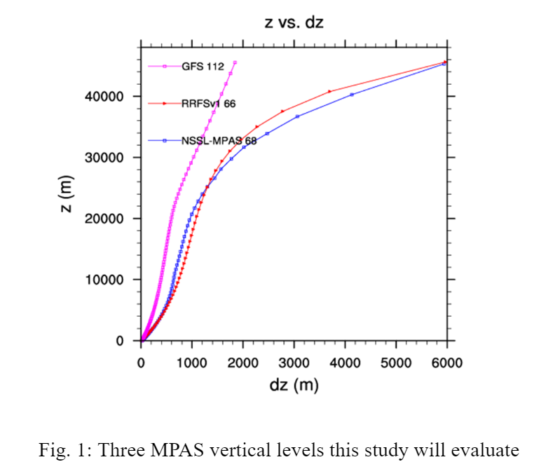
This study investigates the impact of different vertical resolutions on the convection allowing predictions with a regional 3-km MPAS covering the CONUS. Unlike the studies on numerical models sensitivity to horizontal resolutions, vertical level setups are less explored, particularly for regional convection allowing predictions. Three vertical level configurations (Fig. 1) will be evaluated across a series of cases to identify the benefit and disadvantage of each choice. The first configuration extends the model top of NSSL real-time MPAS vertical levels from 25 km to 48 km. The second configuration converts the RRFS vertical levels from hybrid sigma-pressure levels to MPAS terrain following z levels maintaining a similar model top at 48 km. The last configuration modifies the vertical levels from the operational GFS by removing the vertical levels above 48 km. All of the three setups have refined PBL resolutions with the lowest model level at about 10 m and the model top of ~48 km for future satellite data assimilation applications. MPAS forecasts using these three vertical levels will be verified against surface, upper air, precipitation and reflectivity observations. The sensitivity of storm structures and convection initialization to vertical levels will also be examined.
 - Indicates paper has been withdrawn from meeting
 - Indicates an Award Winner