
Handout (10.2 MB)
Using SoOp signals for remote sensing, such as the L-band signals being continuously broadcast by multiple GNSS constellations (e.g., GPS, Galileo, GLONASS, and BeiDou), has been demonstrated as a cost-effective solution to remotely sense Earth atmospheric and surface properties, with special emphasis on its abilities to monitor the water cycle in measuring surface soil and tropical cyclone winds. The MuSat-2 smallsat mission leverages existing dual frequency and dual polarimetric antenna technology developed by Ohio State University (OSU) under the Instrument Incubator Program sponsored by the NASA Earth System Technology Office (ESTO). The mission is an example of the beginning paradigm shift to commercial companies adopting technologies initially proven by NASA pathfinder missions and eventually operated and sustained as commercial ventures. In this regard, MuSat-2, sustains the NASA Cyclone GNSS (CYGNSS) mission and observation record and improves upon CYGNSS capabilities by adding dual polarimetric and dual frequency GNSS-R antennas. Additionally, MuSat-2 measures top-side (i.e., above the spacecraft altitude) total electron content (TEC) using dual-frequency observations from multiple GNSS constellations.
As an example of the shift in government procurement of commercial small satellite data instead of traditional satellite procurement, Muon Space is under contract with the USAF to provide prototype MuSat-2 surface soil moisture, ocean wind speed, and ionospheric TEC products for evaluation under the USAF Commercial Weather Data Pilot (CWDP) program. MuSat-2 is also one of the first operational conventional GNSS-R missions to measure both left-hand circularly polarized (LHCP) and right-hand circularly polarized (RHCP) bistatic radar signals reflected from the Earth surface, similar to the European Space Agency’s planned HydroGNSS mission to be launched in 2025. The MuSat-2 polarimetric GNSS-R antennas are connected to a state-of-the-art, multi-channel software defined radio (SDR) receiver to produce Level 1 (L1) calibrated bistatic radar cross-sections and reflectivity measurements of the Earth surface. These L1 reflectometry data are used to produce Level 2 (L2) geophysical products, such as surface soil moisture and freeze-thaw, ocean surface wind speed (including high winds in tropical cyclones), surface water flood and wetland extent maps, and sea ice extent and type.
In this talk we will describe the ongoing MuSat-2 mission, first scientific results and derived geophysical products, the evolving Muon smallsat bus architectures, the GNSS-R payload consisting of polarimetric antennas and a Muon-designed GNSS SDR receiver, as well as the ground and data processing of Level 0 receiver observables into calibrated L1 engineering products and L2 surface soil moisture and ocean surface wind speed. We will also describe the upcoming MuSat-3 and MuSat-4 missions slated for launch in 2025 that will add significant enhancements to the GNSS payload.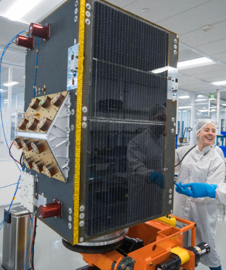
Supplementary URL: https://arxiv.org/abs/2412.00072
 - Indicates paper has been withdrawn from meeting
 - Indicates an Award Winner