
Monday, 13 January 2025: 11:15 AM
345 (New Orleans Ernest N. Morial Convention Center)
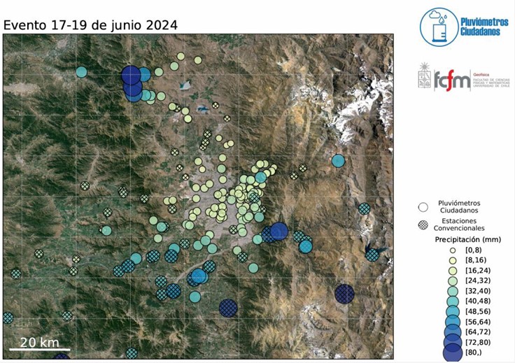
The strong impact of topography in the spatial distribution of rainfall can’t be fully assessed from the information provided by the regular meteorological networks. This impact is studied in the Metropolitan Region of Chile, which includes the city of Santiago, with the collaboration of around 100 highly motivated volunteers (college students, university professors and staff, professionals from different disciplines, housewives, etc) mostly equipped with home made rain gauges. For each rainfall episode, the instructions to install the rain gauges, to measure and inform the accumulated rainfall are sent to mobile phones via whatsapp. The information is combined with that generated by several meteorological networks, which is available in the Web site VisMet (https://vismet.cr2.cl/) of the Center for Climate and Resilient Research (CR-2) Information for 33 rainfall episodes during the period May 2021 to August 2024 is available in the Web site of the project, both in table and map formats (see attached figure as one example). This citizen science initiative has revealed the existence of a significant inhomogeneity in the spatial rainfall distribution within the city and the surrounding region, with different patterns depending on the strength and orientation of the extratropical fronts generating the rainfall episodes. Two areas with complex topography where a local rainfall maximum was observed almost in all episodes were discovered from the observations made by the volunteers of this project. During the 2024 rainy season two similar citizen science initiatives started, in coordination with this one, to assess the spatial rainfall distribution in two adjacent territories. These are led by two professors of the Universidad de Valparaiso (Region V) and the Universidad de O’Higgins (Region VI)
 - Indicates paper has been withdrawn from meeting
 - Indicates an Award Winner