
Thursday, 16 January 2025: 9:45 AM
229 (New Orleans Ernest N. Morial Convention Center)
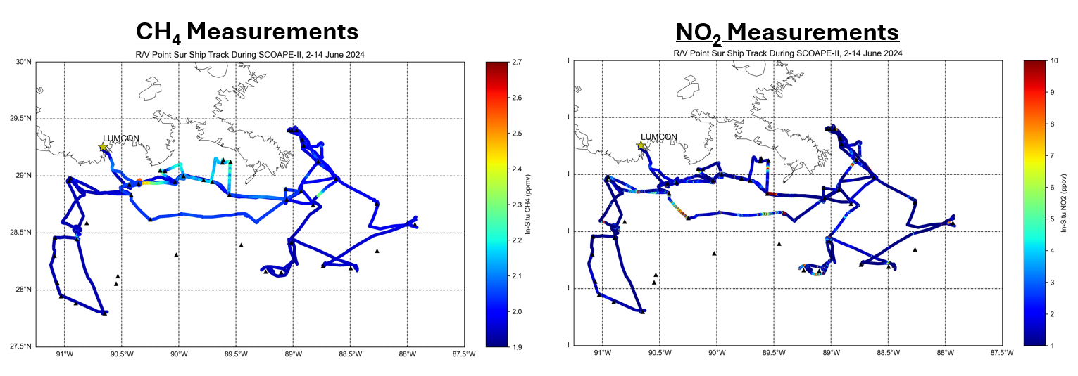
Seven years ago, the Department of Interior’s BOEM (Bureau of Ocean Energy Management), the Agency with Air Quality (AQ) jurisdiction over the western and central United States Gulf of Mexico (GOM) federal waters, asked NASA to determine the feasibility of using satellite data to measure offshore emissions in a region of concentrated oil and natural gas (ONG) operations. To study this issue NASA and BOEM conducted the May 2019 Satellite Coastal and Oceanic Atmospheric Pollution Experiment (SCOAPE) cruise in the GOM. SCOAPE addressed both technological and scientific issues related to measuring nitrogen dioxide (NO2, a common air pollutant) over the GOM, including contrasting near-shore and deepwater regimes (Thompson et al., 2023; https://doi.org/10.1029/2022EA002473). Given the April 2023 launch of the geostationary TEMPO (Tropospheric Emissions: Monitoring of Pollution) AQ satellite and BOEM’s enhanced emphasis on offshore greenhouse gas monitoring, a June 2024 SCOAPE-II was conducted in the GOM with ship and aircraft methane (AVIRIS-3) measurements. We discuss preliminary results (see Figure 1) from SCOAPE-II and highlight the dozens of methane plumes measured near numerous shallow and deepwater platforms.
 - Indicates paper has been withdrawn from meeting
 - Indicates an Award Winner