
The first step towards our goal is to track plumes in satellite retrievals. This task is daunting: plumes deform, split, and merge, and are at times obscured by clouds or simply out of satellites' sight. Additionally, the standard practice of defining plumes as regions containing concentrations of pollutants above a chosen threshold is rendered ineffective by the very dilution we aim to quantify: the choice of concentration threshold should change to reflect plume dilution, but at what rate? These problems are exacerbated when observations have gaps and when diluting plumes approach background pollutant concentrations.
To address these issues, we propose a new plume definition that incorporates both pollutant ('chemical') data and meteorological ('dynamical') data. Our approach views a plume as a collection of pollutant-enriched air masses, where each air mass is a region bounded by dynamical barriers. Dilution is slow across such barriers, and as a result, the envelope of the 'chemical-dynamical' plumes thus defined provides a spatial constraint on dilution processes. By tracking ‘chemical-dynamical’ plumes over time using Lagrangian tools, we aim to more accurately define the volume relevant to quantifying the dilution of the pollutant mass.
We present a proof of concept for our approach using simulated carbon monoxide (CO) and meteorological fields archived from the GEOS Chemical Forecast system. We show that our plume-tracking method can a) reduce sensitivity to the choice of a pollutant concentration threshold to define a plume, and b) overcome the coverage limitations of pollutant data retrieved by satellite instruments. Overall, this new method represents a promising step towards quantifying chemical loss rates by using observations as a primary source of information.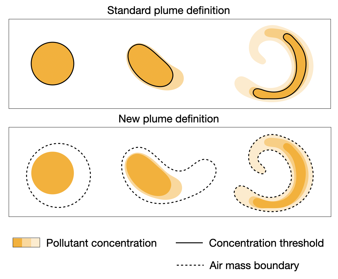
 - Indicates paper has been withdrawn from meeting
 - Indicates an Award Winner