Wednesday, 15 January 2025: 5:45 PM
357 (New Orleans Ernest N. Morial Convention Center)
Kathleen I. Strabala, SSEC/CIMSS, Univ. of Wisconsin-Madison, Madison, WI; and D. J. Hoese
One common requirement that all users of meteorological satellite data share is the need to create high quality images. Creating images from meteorological instruments on polar orbiter and geostationary satellites poses significant challenges, including how to read the data (input formats), the type of instrument that observed the data (Imager, Sounder, etc.), what software generated the data files, and what tool will be used to display the end product (output formats). To simplify this process, NOAA has funded the Cooperative Institute for Meteorological Satellite Studies (CIMSS) at the University of Wisconsin to create a pair of open source command line tools called the Community Satellite Processing Package (CSPP) LEO Polar2Grid and CSPP Geo Geo2Grid software packages. These toolkits provide an easy interface for efficiently reprojecting and converting calibrated radiance data and some higher level science products from supported imagers and sounders into a variety of output formats including GeoTIFF, the US National Weather Service (NWS) AWIPS NetCDF format, Binary and KMZ. Commands are carried out through simple bash shell scripts that wrap underlying python code. As is the case with all CSPP LEO and Geo software, it is freely distributed, is pre-compiled for 64-bit Intel Linux operating systems, is designed specifically to be easy to install and operate, and runs efficiently on modern hardware. CSPP software is used globally by a large contingent of operational environmental decision makers, scientists and students. Global Polar2Grid and Geo2Grid application examples will be included as part of the presentation.
These tools handle all of the complexity involved in this conversion including resampling to custom uniform grids or regions of interest, perceptual enhancements, atmospheric corrections, and RGB, including true color, image creation. Instruments supported include VIIRS, MODIS, AVHRR, AMSR-2 and ATMS. NOAA Environmental Data Products such as Aerosol Optical Depth and ACSPO Sea Surface Temperatures, and HEAP NUCAPS 2-dimensional plane views are also supported. Geo2Grid support includes GOES-,16,-17,-18 and -19 ABI, Himarwari-8 and -9, GEO-KOMSAT-2 AMI and preliminary support for Meteosat Third Generation (MTG) Flexible Combined Imager (FCI).
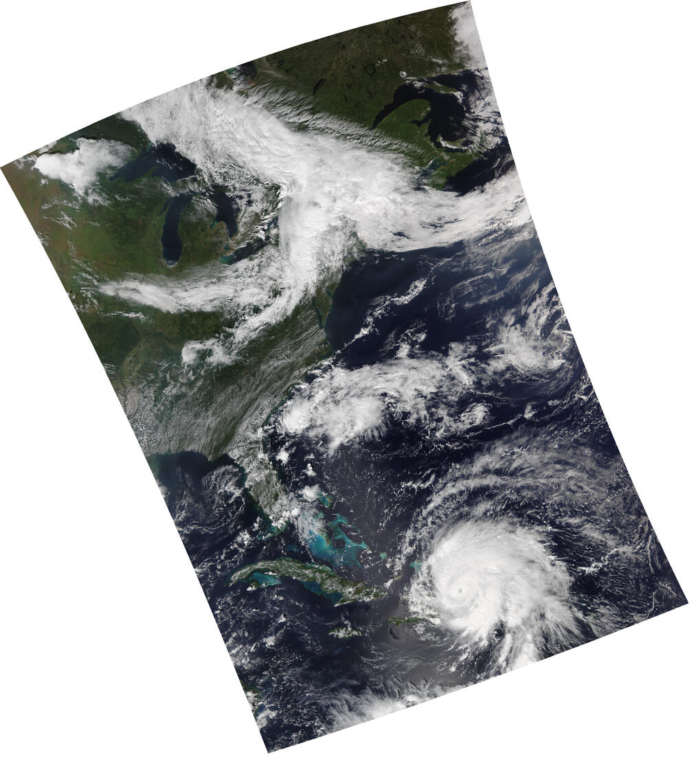
The attached image shows an example of an NOAA-20 VIIRS overpass that was acquired and processed in near-real-time using CSPP software, which includes the creation of this high spatial resolution true color image using Polar2Grid.

- Indicates paper has been withdrawn from meeting

- Indicates an Award Winner
