
The heights to which smoke is injected and detrained governs short- or long-range transport, which influences surface pollution, cloud interaction (altered albedo), and modifies patterns of precipitation (cloud condensation nuclei). We used with the Cloud-Aerosol Lidar and Infrared Pathfinder Satellite Observation (CALIPSO) data to generate a biomass burning (BB) plume height database using multiple platforms, sensors and models (CALIOP, MODIS, NOAA HMS, Langley Trajectory Model). In this presentation, we will demonstrate the process, show plume detrainment height statistics, and provide a specific example that shows the combined competence and accuracy of vertical and horizonal data, when used together.
Statistics that link fire and weather to plume rise are crucial for verifying and enhancing plume rise parameterization in local-, regional- and global-scale air quality, chemical transport, and climate models. Specifically, we will present: (1) a methodology that links BB height and CALIOP air parcels to specific fires; (2) the daily evolution of smoke plumes for specific fires; (3) compare CALIOP-derived smoke plume injection to CMAQ modeled smoke plume injection; and (4) provide statistics from numerous fires burning in multiple ecosystems (e.g., Tripod, Santa Rosa, Rim, Sabine CAN, Charleston, Juniper, Columbia Complex, Pine Ridge, Millard, Black Pulaski, Mendocino, Carr, agricultural fires). These data have the potential to provide enhanced smoke plume injection height parameterization in regional, national and international climate and air quality models.
In one applicable example, we will demonstrate the value of CALIOP aerosol subtypes in the Flint Hills, during the burning season, to distinguish smoke from dust, over time. This demonstration will show how the vertical distribution of aerosol type is crucial to accurately assessing patterns of fire and smoke, with horizontal data. These results have the potential to provide value to local, national, and international modeling communities and to public land, fire science, and air quality management and rules and regulatory communities.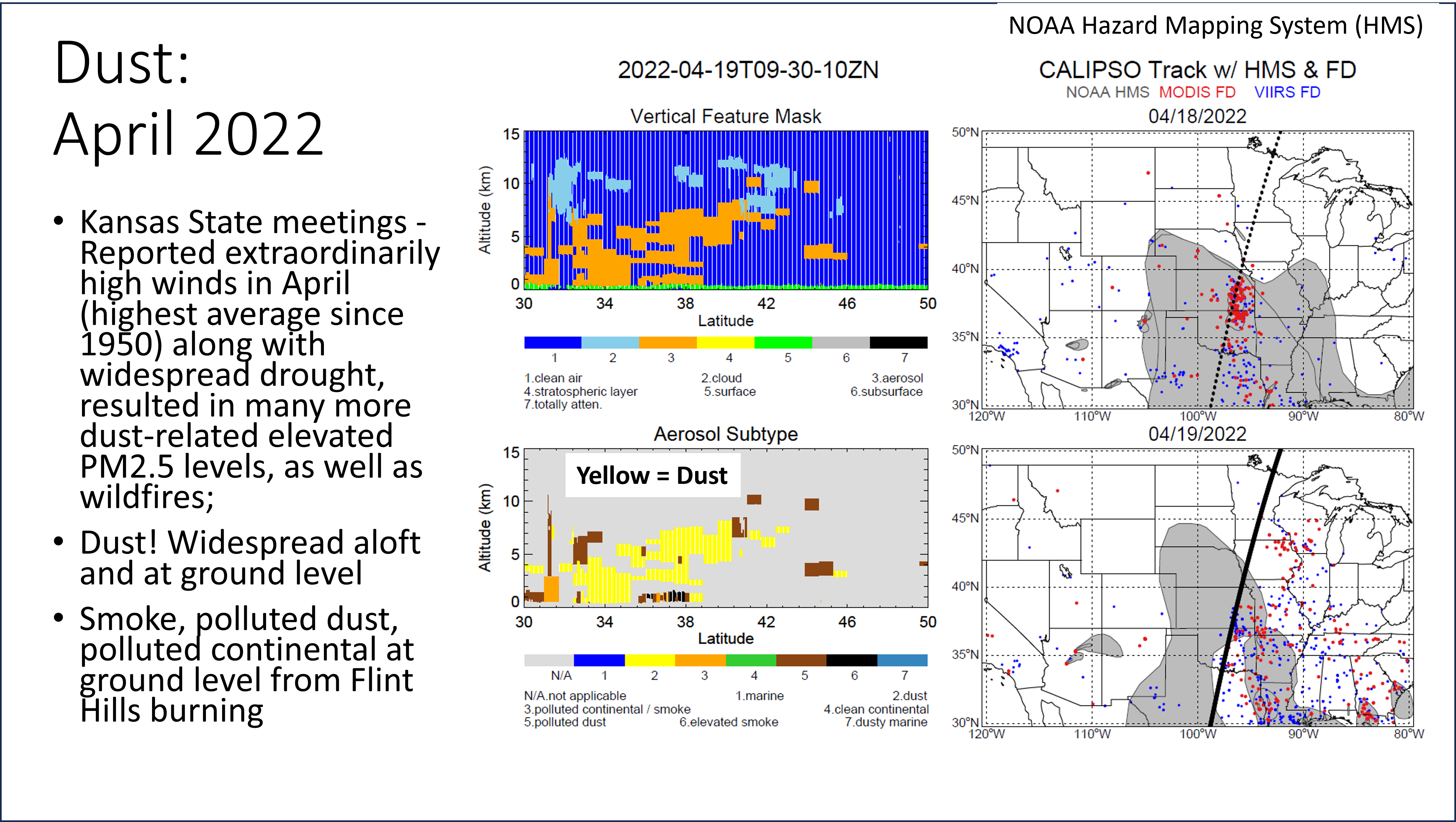
 - Indicates paper has been withdrawn from meeting
 - Indicates an Award Winner