
Persistent smoke and cloud cover often prevent optical sensors from mapping burn scars for days to weeks after ignition. We tackle this challenge by fusing active fire detections from GOES-R ABI with imagery from ABI, NOAA-20/21 VIIRS, Landsat 8/9 and Sentinel-2a/b, and Sentinel-1A C-band SAR to create daily-updating burn maps. SAR and thermal fire signals help to map through optically thick smoke. The coarse-resolution satellites, ABI and VIIRS, provide high temporal resolution which reduces latency by 5-8 times over Landsat or Sentinel. We integrate imagery from higher resolution sensors as soon as they capture clear-sky views. Results from the 2019-2022 fire seasons have been used to calibrate imagery fusion, and demonstrate correlations of r = 0.85-0.87 between bi-sensor burn severity imagery.
Another missing piece of the current paradigm is real-time integration of burn maps into National Weather Service (NWS) GIS platforms and AWIPS (Advanced Weather Interactive Processing System). We will showcase our automated workflow which harnesses Google Earth Engine cloud-computing to rapidly fuse multi-sensor data and export analysis-ready maps, designed for use by NOAA NWS forecasters. We will highlight challenges that remain to operationalizing our product and future improvements. 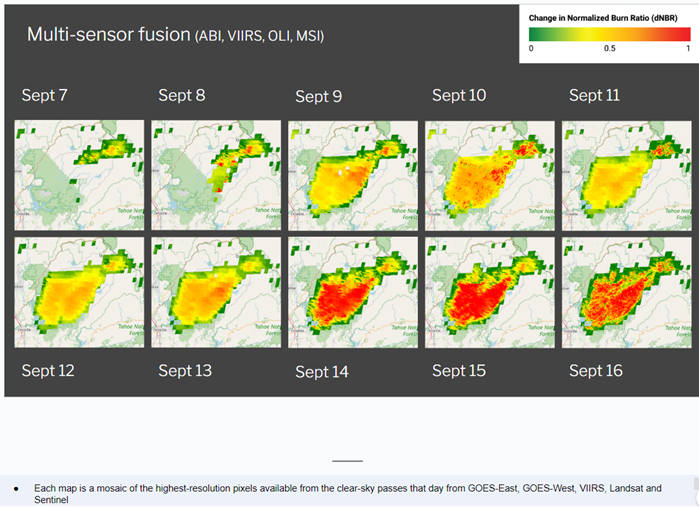
 - Indicates paper has been withdrawn from meeting
 - Indicates an Award Winner