
Handout (2.0 MB)
Hurricane Otis in 2023 exemplifies this risk, having rapidly intensified from a tropical storm to a Category 5 hurricane in under 12 hours before making landfall near Acapulco, a city ill-prepared for such an occurrence. Identifying at-risk communities is essential for effective preparation and recovery efforts.
To evaluate the geographical distribution of risk among coastal municipalities in Mexico, a Social Vulnerability Index to Rapidly Intensifying Hurricanes in Mexico (SoVI RIM) was developed. This index integrates a social vulnerability assessment with an analysis of RI hurricane landfall likelihood. Presented as an ArcGIS map, SoVI RIM categorizes coastal municipalities into five risk levels: “Low,” “Moderately Low,” “Moderate,” “Moderately High,” and “High.”
The social vulnerability index is based on 26 socioeconomic factors indicative of vulnerability to RI, distilled into six primary components through principal component analysis: economic prosperity, housing quality, age/disability, healthcare dependence, exposure/population, and female prominence. Geographical risk was assessed by analyzing historical RI hurricane landfall data from 1950 to 2024 and projected hurricane tracks from nine climate models under the RCP 8.5 for the period 2026-2055. Overall, SoVI RIM highlights the areas of the Yucatan Peninsula, Guerrero, Veracruz, and southern Mexico as most vulnerable, and these findings can guide policymakers, emergency managers, and communities in their development of tropical cyclone resilience initiatives.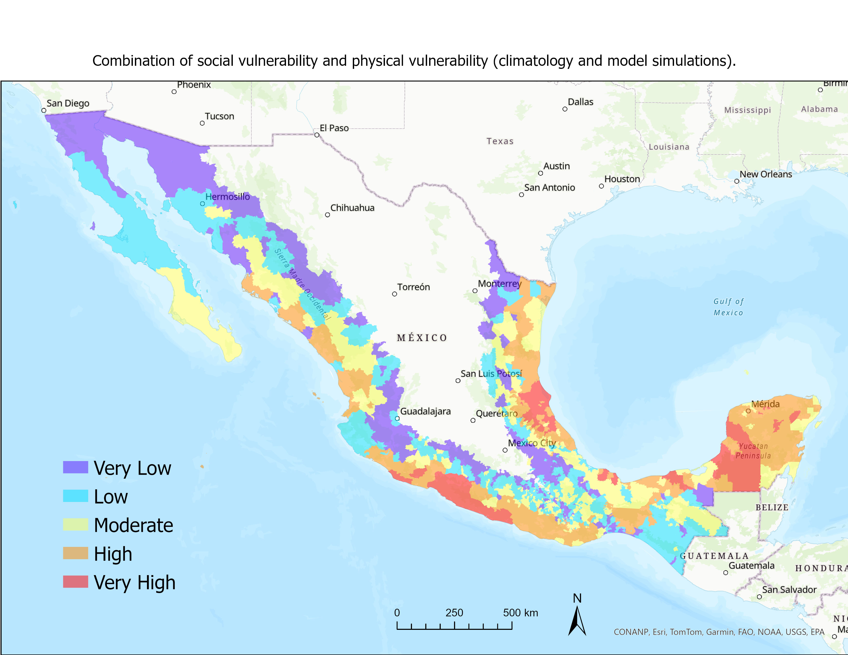
 - Indicates paper has been withdrawn from meeting
 - Indicates an Award Winner