
As MH Beryl tracked closer to Jamaica, its strongest winds impacted the island's southern coastline on 3 July 2024. Automatic weather stations recorded wind speeds of up to 105 km/h at Newcombe Primary School in St. Elizabeth and satellite-estimated wind speeds, from synthetic aperture radar observations over the nearby ocean, reached 220 km/h (119kts). Southern parishes experienced heavy rainfall, with totals as high as 346 mm at Knockpatrick Garth station in Manchester, which exceeded the T25 return period for that station (see image below taken from the Weather Prediction Center International Desks, giving an overview of rainfall amounts). The storm’s rapid intensification resulted from favorably high sea-surface temperatures and a weakening El Niño Southern Oscillation, which combined to create the ideal conditions for such explosive development.
This paper presents a detailed discussion of Hurricane Beryl’s meteorological evolution, its impact on Jamaica, and the uniqueness of this event highlighted by the records broken. The report also examines the broader implications of Beryl’s rapid intensification on forecasting practices and regional preparedness.
The WHAT of MH Beryl will be discussed in this paper. That is W for the Warnings (Early Warnings for All Initiative), H for high ocean heat content, A for attribution (detection and attribution is the missing link to properly attribute events like Beryl with global warming) and T for time (rapid intensification of system).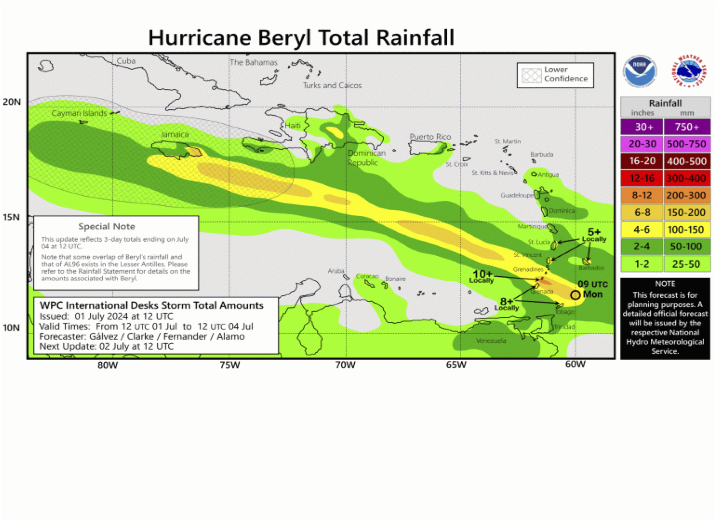
 - Indicates paper has been withdrawn from meeting
 - Indicates an Award Winner