
We use a simplified TC similarity boundary layer model to estimate a corresponding pressure gradient vector for each surface wind vector and employ ordinary least-squares to find a best fit surface pressure pattern corresponding to the SAR image. The surface pressure pattern is validated by comparing measured and derived pressure differences between all possible pairs of drop sondes. The RMS (~2 hPa) is much lower than typical, although the total drop sonde count was lower than typical. A field of gradient winds can be directly calculated from the pressure surface. Hence, the SAR provides both the upper and lower boundary conditions needed by the full similarity TC boundary layer model.
It is well-established that TCBL rolls are associated with large-scale shear instabilities that reach a quasi-equilibrium state. The basic characteristics of these rolls are fairly sensitive to the shape of the mean wind profiles, especially the cross-wind (largely radial) component. The roll orientation angle provides a sensitive metric that is easy to measure using SAR. For fixed boundary conditions the mean wind profiles are in turn sensitive to the vertical profile of eddy viscosity. Using mesoscale model parameterizations as guide, we survey a reasonable range of eddy viscosity formulations to maximize the agreement between predicted and measured roll orientations. Thes profiles are compared to IWRAP wind profiles. We also present a visualization of the roll perturbation winds extracted from IWRAP.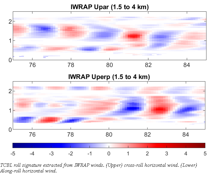
 - Indicates paper has been withdrawn from meeting
 - Indicates an Award Winner