
Handout (1.7 MB)
This project compared seasonal temperature trends and created a heat risk visualization based on various heat-related indices for Chicago. Seasonal linear regression and model analysis plots were generated for ASOS stations Aurora (ARR) and Midway (MDW) airports to compare daily minimum ambient and minimum apparent temperatures. The plots emphasized that Midway, located within the city, experienced warmer daily minimum summer temperatures compared to Aurora, situated outside the city. This difference highlighted the UHI effect, where urban areas retained more heat, resulting in reduced temperature recovery time for populations in the city. Utilizing ArcGIS, spatial datasets, including Multispectral Landsat and Space Agency World Cover, were obtained for land cover analysis to identify urban areas with the greatest need for additional green spaces.
Additionally, various socioeconomic datasets from the American Community Survey (ACS), such as those related to disability status, household income, and insurance coverage, were utilized for comprehensive risk assessment. Highlighting areas with heightened exposure to heat-related risks, these datasets provided important insights into the vulnerability of different communities across the city. By combining temperature data with a variety of socioeconomic indicators, the research was able to pinpoint particular neighborhoods where targeted actions may effectively reduce the negative health effects of heat. Based on these findings, multiple indices covering socioeconomic factors, green space coverage, and temperature variations were combined to generate an overall Heat Risk Index (HRI). The goal of this index was to enhance urban resilience within the city of Chicago. These findings may benefit future research, including integrating climate projections in green space effectiveness and comparative analysis of various green infrastructures.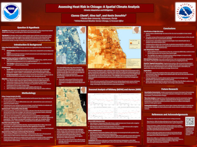
 - Indicates paper has been withdrawn from meeting
 - Indicates an Award Winner