
Tuesday, 7 January 2025
Handout (5.7 MB)
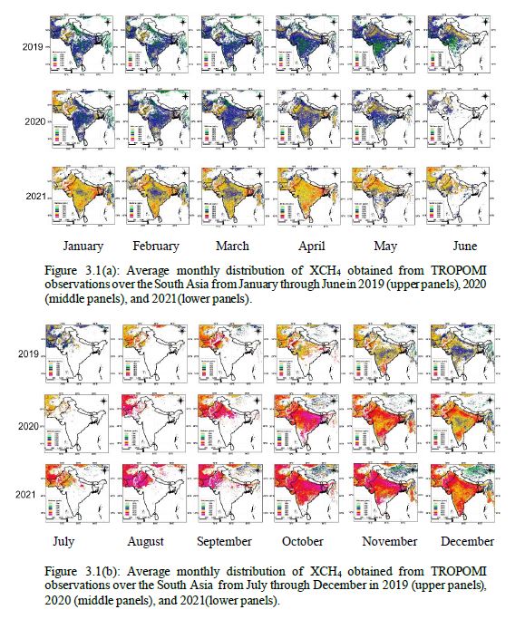
Methane (CH4) is a potent greenhouse gas, trapping 28 times more heat than carbon dioxide (CO2). Food and agriculture contribute about one-quarter of global greenhouse gas emissions, with up to 8% of CH4 emissions originating from South Asia. Bangladesh, with its low-lying topography and 180 million people, produces large amount of CH4 during food production. Annual flooding during the monsoon season affects 20-65% of the country’s land and produces significant amount of CH4 countrywide. Agriculture, which accounts for 41% of the labor force and 15% of GDP, plays a vital role in the global GHG budget, yet Bangladesh's total agricultural GHG emissions, especially CH4’s contribution, remain unknown. While recent studies have identified some key CH4 point sources in Bangladesh using satellite data, emissions from more distributed sources have not been fully quantified. This study explores CH4 emissions in South Asia, with a particular focus on Bangladesh, using columnar dry-air mole fractions (XCH4) from the TROPOspheric Monitoring Instrument (TROPOMI) onboard the Sentinel-5 Precursor satellite. Analyzing six years of data from 2019 to 2024 revealed clear seasonal variation and a consistent year-by-year increase in CH4 levels, with a growth rate of 16.1 ppb, closely matching the 17 ppb observed by GOSAT. TROPOMI’s high spatial resolution allowed for the identification of country-specific features. In Bangladesh, XCH4 levels remained high throughout the year, likely driven by emissions from paddy fields, a significant source of CH4. High CH4 concentrations were also detected in Dhaka, the capital city. Since 2014, weekly flask sampling of greenhouse gases has been conducted in Cumilla, Bangladesh. Comparing CH4 data from 2019 and 2020 between TROPOMI and flask observations showed a low correlation. The high values from flask sampling suggest multiple local CH4 emission sources around the Cumilla site, which TROPOMI’s field of view (7×5.5 km²) could not capture at such small spatial scales. This highlights the difficulty in detecting localized CH4 increases using satellite data. The significance of our study lies in its ability to provide a deeper understanding of methane emissions in Bangladesh and South Asia, using satellite data to identify key sources and trends, which can inform targeted mitigation strategies for reducing greenhouse gas emissions and addressing climate change.
 - Indicates paper has been withdrawn from meeting
 - Indicates an Award Winner